UN
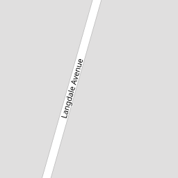
28 Langdale Avenue
£ 75,000
Description
We don't have a Description for this property.
- Bedrooms
- 2
- Bathrooms
- 0


Leaflet © OpenStreetMap contributors
The heatmap indicates the level of crime in the area. The color of the heatmap indicates the crime severity and recency.
Metrics Year-on-Year
- Average area value
- 279,983.00 £Decreased by 14.38 %
- Average area rental value
- 1,013.00 £/moDecreased by 7.91 %
- Est rental Yield
- 4.34 %Increased by 7.43 %
- Crime Rate
- 1.00 %Unchanged by 0.00 %
from 327,013.00 £
from 1,100.00 £/mo
from 4.04 %
from 1.00 %
Nearby Schools
| Name | Type | Ofsted | Distance |
|---|---|---|---|
| Newington Children'S Centre | Children's Centre | 0.44 KM | |
| Newington Community Primary School | Community School | Outstanding | 0.56 KM |
| Chilton Primary School | Academy Converter | Outstanding | 0.74 KM |
| St Laurence In Thanet Church Of England Junior Academy | Academy Sponsor Led | Good | 0.89 KM |
| Ramsgate Arts Primary School | Free Schools | Good | 0.98 KM |
Images
Nearby Streets
| Name | Average Price | Average Sqft | Distance |
|---|---|---|---|
| Staner Court | £ 127,500 | 0 | 0.00 KM |
| Grasmere Avenue | £ 324,950 | 0 | 0.00 KM |
| King Charles Avenue | £ 280,000 | 0 | 0.00 KM |
| Wentworth Drive | £ 0 | 0 | 0.00 KM |
| Telham Avenue | £ 230,000 | 0 | 0.00 KM |
Nearby Transport
| Name | NLC | TLC | Distance |
|---|---|---|---|
| Ramsgate | 5023 | RAM | 1.51 KM |
| Dumpton Park | 5034 | DMP | 3.72 KM |
| Broadstairs | 5006 | BSR | 5.14 KM |
| Margate | 5018 | MAR | 5.81 KM |
| Westgate-On-Sea | 5195 | WGA | 7.78 KM |
Nearby Listings
| Address | Price | Type | Score | Distance |
|---|---|---|---|---|
| Langdale Avenue, Ramsgate, CT11 | £ 375,000 | BUY | 7 / 10 | 0.01 KM |
| Windermere Avenue, Ramsgate, CT11 | £ 300,000 | BUY | 6 / 10 | 0.13 KM |
| Windermere Avenue, Ramsgate, Kent, CT11 | £ 325,000 | BUY | 7 / 10 | 0.13 KM |
| Windermere Avenue, Ramsgate, CT11 | £ 375,000 | BUY | 6 / 10 | 0.14 KM |
| Windermere Avenue, Ramsgate, Kent, CT11 | £ 495,000 | BUY | 7 / 10 | 0.16 KM |
Nearby Properties
| Address | Price | Distance |
|---|---|---|
| 39 Langdale Avenue | £ 243,995 | 0.00 KM |
| 32 Langdale Avenue | £ 160,000 | 0.00 KM |
| 36 Langdale Avenue | £ 270,000 | 0.00 KM |
| 52 Langdale Avenue | £ 191,000 | 0.00 KM |
| 33 Langdale Avenue | £ 155,000 | 0.00 KM |